(Updated: 6/25/2026)
Current Beach Status
We're happy to report that all but one of the public beach park facilities throughout the Fort Myers area are open.
Sargassum Update:
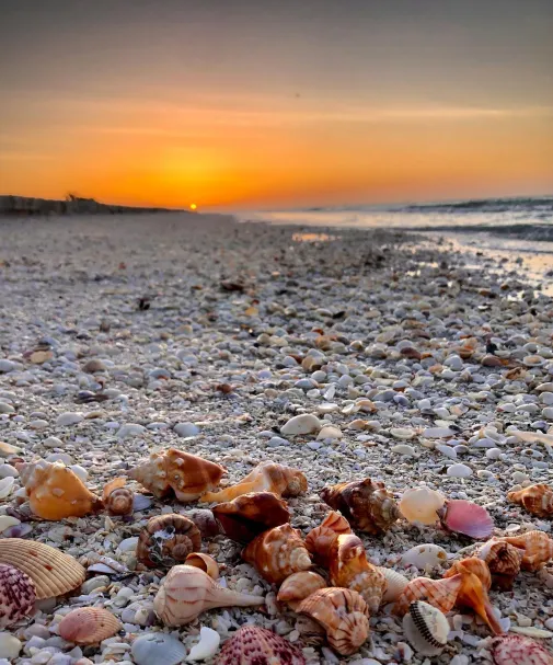
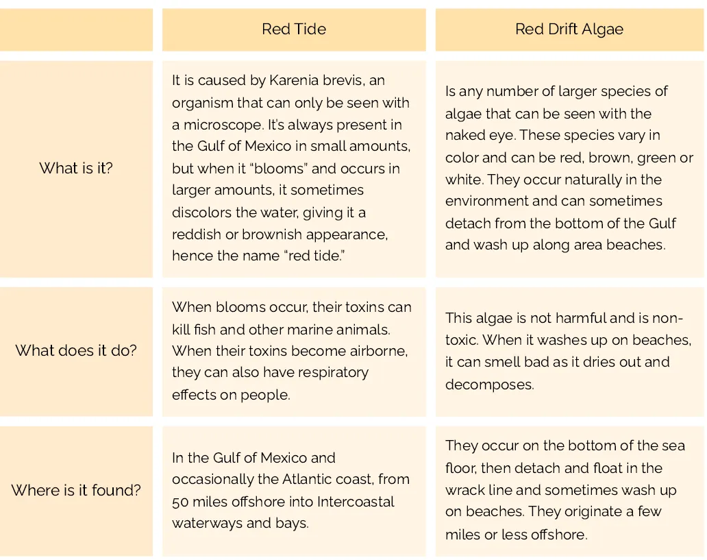
Sargassum is a naturally occurring seaweed that sometimes washes ashore on Southwest Florida beaches, particularly in late spring and summer. While it can be present at times, conditions change frequently based on winds and tides, so what you see one day may be completely different the next. Many beaches across the Fort Myers area remain pristine, and our teams work to keep shorelines as enjoyable as possible. For the latest conditions, check the Beach Conditions Reporting System (Mote Marine Laboratory).
Please note: Most parking fees are through a parking system with the ability to pay by text message, a mobile app, through a website or at a kiosk. Learn more here.
Open Public Beach Parks:
- Bowman's Beach Park (Sanibel Island) $5/hour parking
- Gulfside City Park (Sanibel Island) $5/hour parking
- Tarpon Bay Road Beach (Sanibel Island) $5/hour parking
- Lighthouse Beach Park (Sanibel Island) $5/hour parking. The Gulfside parking lot is open; the two bayside parking lots are currently closed.
- Blind Pass Beach (Sanibel Island) $5/hour
- Causeway Island Parks (Sanibel Causeway)
- Dog Beach (Bonita Springs) No restrooms available
- Bowditch Point Park (Fort Myers Beach) No restroom available. $2/hour parking (may be unavailable due to construction around the area)
- San Carlos Bay-Bunche Beach Preserve (Fort Myers) $2/hour parking
- Yacht Club Beach (Cape Coral)
- Crescent Beach Family Park (Fort Myers Beach)
- Lynn Hall Memorial Park (Fort Myers Beach) $2/hour parking Please note: the parking lot at Lynn Hall Memorial Park will close on 4/6/2026 until the summer of 2027 for the construction of new elevated restroom facilities. During construction, portable restroom facilities and a pedestrian access walkway will remain open on the west end of the park. Learn more about additional parking options for Lynn Hall Memorial Park here.
- Bonita Beach Park and Bonita Beach Access 1 (Bonita Springs) Bonita Beach Accesses 2-10 are still closed. $2/hour parking
- Cayo Costa State Park -The beach facing the Gulf of Mexico at Cayo Costa State Park is open daily, 8 a.m. to sunset for those with private vessels. Ferry services, docks, electricity, drinking water and overnight accommodations are not available. Access to the island is not available from Pelican Bay. Restrooms are available on the Gulf side of the island. Please adhere to all posted signs and avoid closed areas.
- Lovers Key State Park (Bonita Springs) $8/vehicle for the day parking (hiking trails are still closed)
- Gasparilla Island State Park (Boca Grande and Outer Islands) The Range Light Parking Lot and the Sea Grape Parking Lot are open. Parking: $3/vehicle, $2/pedestrian or cyclist
- Boca Grande Beach Accesses (Boca Grande and Outer Islands) are open on the following streets: 1st, 10th, 11th, 12th, 14th, 17th and 19th. Please note: Recent updates to parking have been made in Boca Grande. Learn more here.
- Alison Hagerup Beach Park (Captiva Island) Parking: 1 hour - $15, 2 hours - $25, all day (dawn to dusk) - $40
- Turner Beach (Captiva Island) $5/hour
Closed Public Beach Parks and/or Parking Lots:
- Fort Myers Beach Access #17
- The main parking lot at the Port Boca Grande Lighthouse is closed at Gasparilla Island State Park (Boca Grande and Outer Islands)
Currently Closed Long Term:
- Newton Park Beach (Fort Myers Beach)